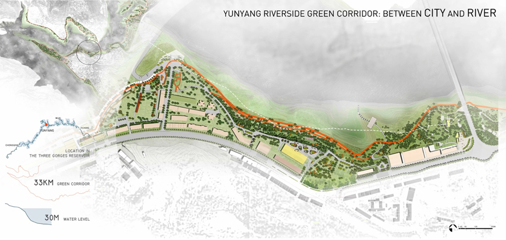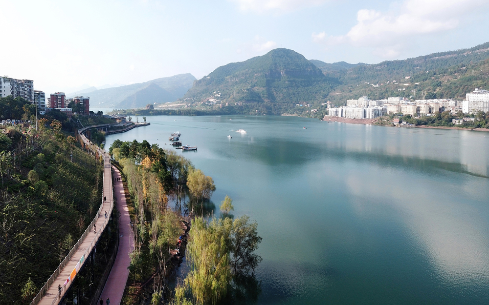
90年代初期,全球规模最大的水电站——三峡水利枢纽工程开始在长江上游兴建,这最终导致了约113万人口离开原来的家乡搬入新的城镇,云阳便是这样一座“三峡移民新城”。始建于1992年的云阳县城位于三峡水库岸边,长江与彭溪河交汇处的三角形山坡地带,经历快速的城市化发展,目前云阳县城人口已经超过28万。县城以山脊上的古代军事城堡作为布局的核心,被长江及其支流环抱,既有“山城”之险,又兼具 “江城”之秀。
In the early 1990s, the world's largest hydropower station, Three Gorges Project launched on the upper reaches of the Yangtze River, which finally caused about 1.13 million people moving into new towns. And Yunyang county is such a "Migrant Town of Three Gorges", built in 1992, located in the northeast part of Chongqing and on the bank of Three Gorges Reservoir, a triangular hillside where Yangtze River meets Pengxi River. Now the population is over 280,000. The unique topography endowYunyang with the characteristics of both mountainous city and riverside city.
2014年底,我们有幸在云阳环城水岸环境规划设计的公开竞赛中中标。规划用地位于长江、澎溪河沿岸,环绕大部分城区,岸线全长33公里,研究涉及面积约 448 公顷,其中近44%位于三峡库区消落带。总体规划完成后,从2015年开始,云阳河沿岸地区的更新已分阶段实施。其中,城北彭溪河滨江绿道已于2018年竣工并向公众开放。
At the end of 2014, our team were honored to win the first prize of the Yunyang city-round waterfront environment planning and design competition. The planned site is located along the Yangtze river and the Pengxi river, encircling most of the urban areas. With a total length of 33 kilometers, the research area of the plan covers about 448 hectares, of which nearly 44% is in the hydro-fluctuation belt of the Three Gorges Reservoir area. After the completion of the master plan, the renewal of the area along the yunyang river has been implemented in stages since 2015. Among them, the riverside greenway along the pengxi river to the north of the city has been completed and opened to the public in 2018.
云阳城市公共生活与滨水环境中的诸多问题源于移民压力下的快速城镇建设和三峡库区的运转。主要问题有:
①破碎而消极的滨水地带。滨水地带大量被住宅、办公、酒店、码头等建筑和设施侵占,导致滨水绿地分布被割裂,而山城的地形变化带来江岸大量高耸的自然崖壁和陡峭的工程护坡则使得城市与江水脱离,甚至部分滨水区域成为堆积城市建设弃土或建设城市市政管道的消极地带。
②三峡库区周期性蓄水导致的30米消落带问题极为棘手。枯水期水位下降后,沿岸裸露出大片的土坡和工程化驳岸,严重影响了城市沿江景观,进一步疏离了城市和长江的关系。
复杂、动态、多样的水岸环境虽然是云阳城市问题所在,但也具备了创造性更新的潜力。景观设计师以关注民生和尊重自然为理念,通过多方合作,运用创造性的思维与多样的手法将水岸的诸多负面资产整合、转化为积极、正面的城市景观资产。同时设计也没有止步于城市休闲公园,而是力图营建一条连接城市与河流,联系28万市民的社会&生态基础设施走廊。
Most problems bothering Pengxi River waterfront are caused by the rapid urban construction under the pressure of migration and by the operation of the Three Gorges Reservoir area. Mainly listed as:
1. The fragmentized and passive waterfront space. Waterfront area is largely occupied by buildings and facilities, resulting in the fragmentation of waterfront green spaces. Meanwhile the topography of mountain city brings numerous towering natural cliffs and steep revetment separating the city from the river. Even some waterfront areas became the negative space with urban construction waste and sewage pipeline.
2. The 30-meter-high hydro-fluctuation belt caused by the periodic water storage of the Three Gorges Reservoir is extremely tricky. When the water level drops in summer, large areas of soil slope and engineering revetment are exposed, which seriously deteriorate the landscape along the river.
Although the waterfront area is the core environmental problem of Yunyang, it also has the potential to become an engine for city renewal. With the ideology of concerning social function and respecting nature, landscape architects transform negative assets of the waterfront into positive urban landscape resource through multi-discipline cooperation, creative strategies and diversified approaches. More than an urban park, the proposal tried to structure a social & ecological corridor, connecting city and the river, benefiting 280,000 citizens.

因此,彭溪滨江绿道的实施主要采取了2个设计策略:
1.滨江慢行系统
在总体规划层面,提出了一个雄心勃勃的目标,即在整个滨水区创建一个缓慢的交通系统,从而整合分散的城市空间,将城市和河流连接在一起。
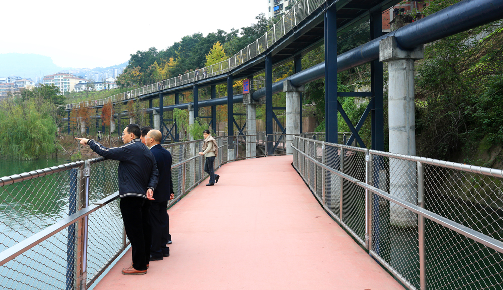
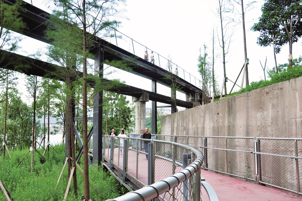
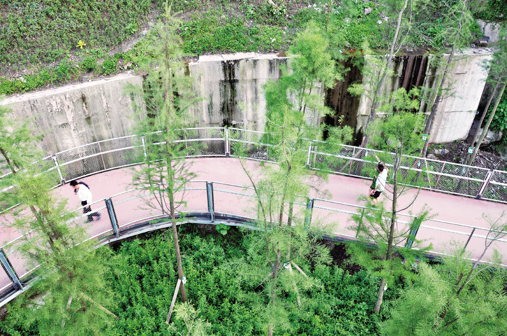
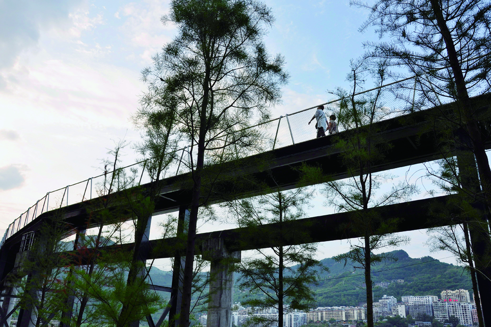
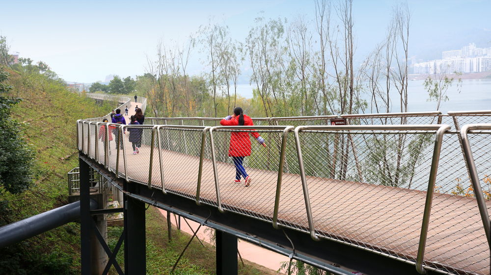
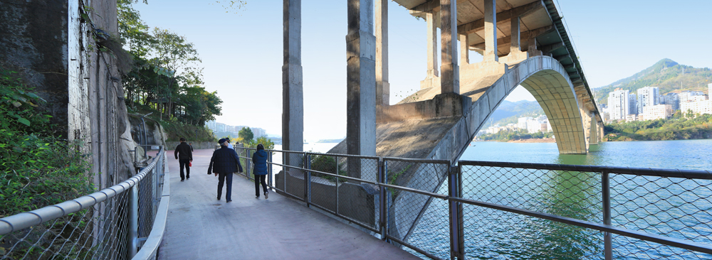
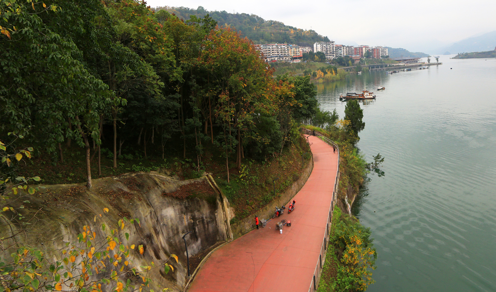
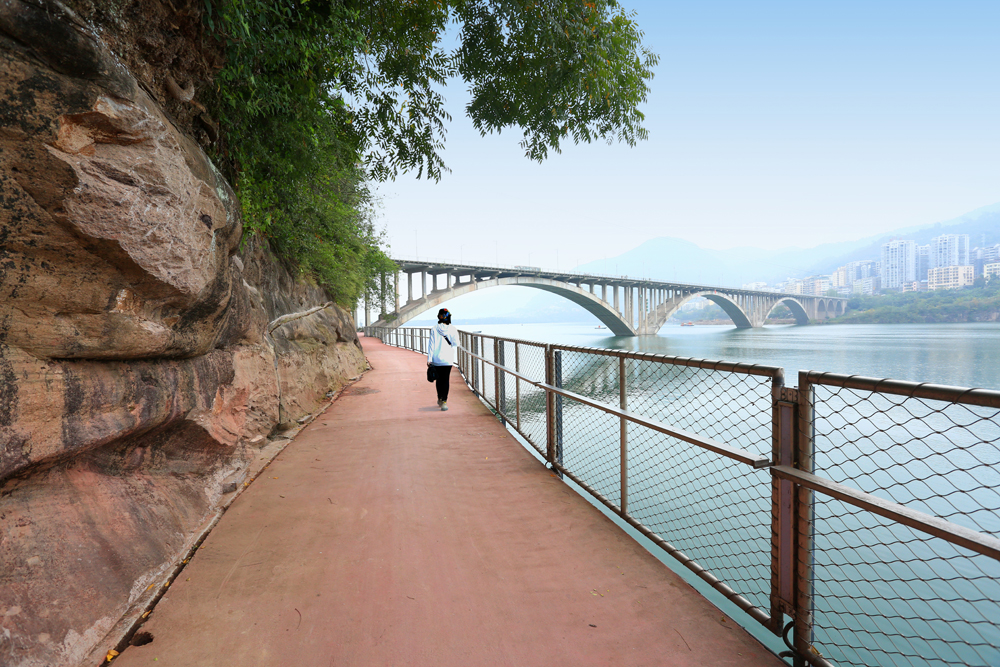
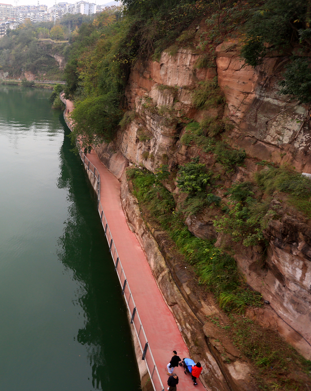
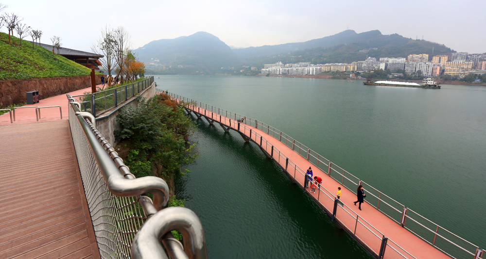
长达33公里的复杂滨水区采用多种方式连接,其中彭溪滨水区是最复杂的部分。河流与城市高差达20米,市政桥梁从高处跨过,城市污水管道沿岸通过。设计在不同的高度建造了两条步道。较低的步道沿水库最高水位布置,平坦且亲水,可供步行和骑行。上层的木栈道是一条架设在420米长的污水管道上的人行道,消除了污水管道的负面影响。上下人行道相互交错,提供了从城市到江边的可达性。在悬崖区,沿河悬挑的木栈道呈现出壮观的景色。在双江大桥桥下段,木栈道利用桥两侧突出于桥墩的两块自然岩石作为结构基础,从大桥结构中穿过,实现了沿江的慢行交通连接。
2.消落带景观
每年,随着春夏两季水位的下降,消落带中会自然萌发出乡土草本植物,覆盖住裸露的地表。为了保护这一自然过程,在消落带尽量保留现有地形,仅在已建区域采取生态和景观措施加固护岸。
同时设计在水岸高程较高处种植一些乡土的水生、湿生及耐湿植物,丰富岸线景观及生物多样性。此外,消落带中还设置了一些简洁的步道和平台,在低水位时供市民活动。因此,通过对消落带的轻微干预,江水周期性的变化得以强化和表现。
Therefore, the implementation of the Pengxi riverside greenway mainly includes two main design strategies:
1.Slow traffic system through riverbank
At the level of the master plan, an ambitious goal is proposed which is to create a slow traffic system throughout the whole waterfront so as to integrate the scattered urban spaces and stitch the city and river together.
Various methods are adopted to link the 33km-long complex waterfront area, among which Pengxi riverfront makes the most complicated part. The height difference between the river and city reaches 20 meters, with viaduct crossing and urban sewage pipes running by.Two walkways in different levels were constructed. The lower walkway is arranged along the highest water level of the reservoir, being flat and close to water, and available for walking and cycling. The upper boardwalk is a walkway erected above the 420-meter long sewage pipe, eliminating its negative impact.The upper and lower walkway interlace with each other, providing the accessibility to the waterfront from the city. In the natural cliff area, the riverside boardwalk is overhung, presenting a spectacular view. At the section under Shuangjiang Bridge, the boardwalk runs through the bridge pillars, with its structure laying on the natural rocks on both sides, realizing the slow-traffic connection along the river.
2. Landscape of Hydro-fluctuation Zone
With the water level drops in spring and summer, some native herbs could spontaneously germinate on the bare surface of the hydro-fluctuation zone. For preserving this natural process, the existing topography was kept as much as possible in the hydro-fluctuation zone, ecological and landscape measures were only conducted in the constructed areas to reinforce the revetment.
At the same time, some native aquatic plants and hygrophytes were planted at the water bank at relatively higher elevation, to enrich the shoreline landscape and biodiversity as well. In addition, some simple trails and stone platforms are created in the hydro-fluctuation belt, which can be used at low water level. Therefore, through the slight intervention of the hydro-fluctuation zone, the periodic change can be visualized.
在中国,拥有28万人口的云阳仅仅是一座普通的县城。澎溪河滨水绿道不仅作为一张城市新名片在推动云阳的旅游经济中发挥重要的作用,同时也作为连接城市和河流、滨水地区和公共生活的纽带,成为中国三峡库区城市和其他滨水城市水岸治理和环境改善的典范。
Yunyang, with a population of 280,000, is an ordinary county in China.The Pengxi riverside greenway will play a significant role not only as a new city name card benefiting its tourism economy, but also as the link connecting the city and river, waterfront and public life, becoming a model of urban riverbank management and environment improvement in China's Three Gorges Reservoir area, and even in other riverfront cities.
主持设计:王向荣、林箐
设计团队:李倞、刘通、张诗阳、郑小东、李洋、张铭然、阳春白雪、华锐、任维、金佳鑫、王譞、许璐、韩宇、常弘、赵真真、李康、王宇航、张雪葳、袁敬、刘京一、段诗乐
Leader Designer:Wang Xiangrong、Lin Qing
Design Team:Li Liang、Liu Tong、Zhang Shiyang、Zheng Xiaodong、Li Yang、Zhang Mingran、YangchunBaixue、Hua Rui、Ren Wei、JinJiaxin、Wang Xuan、Xu Lu、Han Yu、Chang Hong、Zhao Zhenzhen、Li Kang、Wang Yuhang、Zhang Xuewei、Yuan Jing、Liu Jingyi、DuanShile


